

Full-day country walks in
SE England and beyond
Marlborough to Avebury
Distance: 11.9 miles.
Time without long breaks: Apx 6 hours.
Terrain: A few hills but nothing too steep.
How to get there and back: Train to Swindon then an X5 or No. 80 bus to Marlborough from Swindon bus station (5 mins walk from the train station). Buses run half-hourly. Get off at Marlborough High Street. Return on No. 49 bus from Avebury to Swindon, then train.
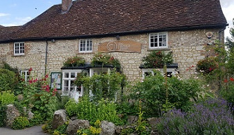
Pub breaks: The Oddfellows at Manton is near the start of the walk. The Who'd Have Thought It at Lockeridge is half-way through, so great for a lunch stop. The walk ends at the Red Lion in Avebury.
More information: This walk will take you to the main sites at Avebury. An alternative route is walk 26 from Ogbourne St George. There is also an Avebury circular walk, which takes in all the sites in the area.
Click on the image below to access the full map on plotaroute


Starting in the historic Wiltshire town of Marlborough, famed for its private school and Georgian High Street, this route follows the valley of the River Kennet and takes you through small villages of thatched cottages and old churches. It includes some of Britain's best ancient monuments: the Devil's Den dolmen and – within the Avebury World Heritage Site – West Kennett long barrow, Silbury Hill and the Avebury stone circles. There are pubs at the halfway point and at the end of the walk.
Marlborough is one of Wiltshire's finest towns, with many old buildings. To start the walk, head south down the High Street (one of the widest in Britain). When the road divides at the church, take the right-hand fork. Then turn right at the end and follow the road round, going under the arch to reach the main entrance to Marlborough College. Established in the mid 19th-century, the boarding school's famous alumni include John Betjeman, Siegfried Sassoon and Nick Drake. In the school grounds (and visible from the second entrance you pass), is the Marlborough Mound, a man-made neolithic hill of unknown purpose. It is also known as 'Mini-Silbury' due to its similarity to Silbury Hill, also on this route.

Turn right at the junction and follow the road. You cross over the River Kennet again. About 80m further on, take the residential turning on the right and look for a path on the left that runs alongside the second house. This leads to the main road. Cross over at the pedestrian crossing and continue up the path directly opposite, still on the White Horse Trail. You pass houses on the left. Just after the houses end, there is a junction with a path coming off to your right. Continue straight ahead following the sign. After 500m, you reach a signpost. Turn left here and follow the path across the field aiming for a small clump of trees. You emerge at a lane. Turn right, soon passing the entrance to Manton Park Farm.

Cross the field, go through the gate and follow the fence to your left down to the valley bottom. You will see a cluster of rocks on your right. Take the small gate to the right of a farm gate on your left and follow the path, turning right through an open gate to reach Devil's Den (see below), a handsome neolithic dolmen believed to have once been part of a larger passage grave. It is thought to be around 3,000 years old. Leave the field the way you came in. This time when you reach the gate by the rocks, head across the field, with an embankment to your right, aiming for a small group of solitary trees. When you reach the trees, turn left via a gate and proceed up the track.

In about 250m you reach the village of Lockeridge and the Who'd Have Thought It pub. We found this place extremely welcoming and it seems to be a village pub that is thriving, despite being a bit off the beaten track. It's a good place to stop for a pint or some food, as you are almost exactly half way through the walk. When you leave the pub, carry on walking in the same direction as before and when you reach the road junction by the school, turn right. Follow this lane for about 3/4 of a mile, passing a village hall and a stud farm, until you see a lane coming off on your right by a bend. Turn down this lane to reach West Overton Church.

Follow this road, which has views towards Overton Down on your right. In about 1km you reach a junction by a house with a stone wall ahead. Turn left and then immediately right down a narrow path that runs past the side of a house. When it comes out at another lane, turn right and then take the next turning on your left, down Church Lane. There is a handily-placed bench here if you fancy a rest. Just beyond the old cottages is East Kennett Church, which has a small garden at the front alongside the road. Follow the lane round and take the track between a house on your left and some stables on your right which then passes through a gate.

The path emerges at a field. Follow it along the field's edge and then turn left to walk through the next field, with the River Kennet to your right, aiming for a pair of double gates onto a lane. Cross the lane and continue along the track opposite in the same direction. In just under a mile, you will see a path coming off to the left and heading uphill. This will take you to West Kennett long barrow. This impressive chambered tomb was built around 3,650 years ago. The remains of around 50 burials have been discovered in the chambers, which you can enter. This is a good place to take a break before the final section and you can sit on top of the barrow and admire the view of Silbury Hill below.

Follow the path straight ahead, with the hill to your left. It follows the River Kennet. At one point by a gate and a stile, it confusingly divides. Go over the stile and follow the path furtherst from the river as it will be less muddy. When the paths remerge there is a bridge over the river on your left. From the other side of the bridge, there is a gap you can go through to enter the field and follow a path to the hill to see it up close. From the bridge, continue heading north along the bridleway, the river still to your left. After half a mile you will reach a road. Cross over, turn right and then left into the car park for Avebury. Aim for the far opposite corner of the car park and take the path on the right that leads out of it.


Just after the second college turning, take the footpath on the left. It runs parallel to the road, and then bears left, crossing a stream and the River Kennet. It soon reaches the church of St George, Preshute. Exit the churchyard on the opposite side to where you came in and turn right past a college building with a flint wall to your left. Keep going down this lane, which runs parallel to the river across on your right. You are now on the White Horse Trail, which you follow for the next section of the walk. After half a mile, you reach a junction in the village of Manton (look out for the hares on top of the thatched house straight ahead). There is a pub here, the Oddfellows, which has a lovely beer garden.

Follow this lane (which has warning signs about crossing racehorses). It bends left at a corner (you can take the path that runs parallel to the road here). After you pass a shaw on your left, you reach a car park. Cut across this and take the track that leads off the far corner, continuing in the same direction as before. There are views across the downland from here and you can also see Devil's Den dolmen below, which you will reach shortly. When the track bends right, you come off the White Horse Trail and join a bridleway. You can either climb over the farm gate straight ahead or walk around the corner and go through the swing gate.

You pass some stables at Fyfield Hill before the track reaches the summit and then starts to descend past Fyfield Farm to reach the A4. Take care crossing over and take the lane opposite passing a T-junction sign. You come to 13th-century Fyfield Church on your left. Follow the lane around past the lychgate and houses on your right with a fence to your left. When the lane ends, just after you pass a thatched house and a building on the left, take the path straight ahead which leads to a gate to a field. Keep on the path, with open fields to your left, until it reaches the driveway to a house. Walk up the drive to the lane and turn left.

The church, dedicated to St Michael and All Angels, is in a beautiful setting, surrounded by thatched cottages. Exit the church opposite the way you came in, passing a house and stone wall on your right with a wooden fence to your left. Follow this lane down towards the centre of the village. When you reach a junction with a white thatched house on your left, carry on straight ahead. You will come across a bus shelter on your right that has been turned into a local free book depository. Carry on along the road, going round a bend to the left when a road merges from the right. The road then swings right to head out of the village.

The track swings right and runs along the edge of a field. To your left you can see a mound with a clump of trees on it. This is East Kennett long barrow. Although less well-known than its West Kennett sister, it is one of the longest neolithic barrows in the country. After about 250m along this track, you will come to a crossroads of paths by some barns. Turn right here to rejoin the White Horse Trail (if you want to get a closer look at East Kennett barrow, you can turn left here. It is on private land with no public access, but you can view it from the bridleway. The detour, marked on the map, is just under a mile). After 300m, the track crosses a public byway (turn left and then right to carry on in the same direction).

To get to Silbury, return back down the path, but then take a left at the bottom. Turn right after going through a gate then cross a bridge over the river. The path comes out at the main road. Take care crossing over and continue along the White Horse Trail. The purpose of Silbury Hil, which dates from around 2,400 BC and stands 30 meters high, has never been determined. Excavations have not given archaeologists many clues and some carried out centuries ago in an attempt to discover burials have damaged the site. As a result, climbing the hill is now prohibited. It is on private land, although it is possible to get a closer look than from the bridleway (for more on Silbury see the panel on walk 51).
You pass some info boards on your left. Just beyond this, rather than carrying on straight ahead along the track, turn left along a narrow path. This comes out at the bottom of Avebury High Street, which is full of quaint old houses. You pass the fascinating church of St James on your left (behind which are Avebury's two museums). A bit further down, also on your left, opposite The Henge new age shop, is Avebury Dairy, which has a milk vending machine (you can add shots of various flavours). At the top of the lane is the Red Lion pub, opposite which you will find the main sections of the stone circles that surround the village (for more on this remarkable site, see walk 51). Buses back to Swindon stop right outside the pub and run until mid-evening.
Around the time Julian Cope began research for The Modern Antiquarian (see panel on walk 51), he released his album Peggy Suicide. The album (brilliantly praised here by The Quietus) marked the beginnings of Cope’s own brand of political activism which incorporates feminism and environmentalism via a love of ancient landscapes. This is also present in his 20 Mothers album, his Black Sheep busking tour and in his most current music. It is the artwork on Peggy Suicide that links to this walk. If you flip over the cover featuring the primordial Mother Earth, you will discover a brooding Cope at Devil’s Den along with the enigmatic Squbbsy. His fieldnotes for Devil’s Den come from the year of Peggy Suicide’s release. He describes the area as a ‘magical place – a magnificent Pastureality on 360 degrees’ and likens the cromlech to ‘an ancient sprinter about to shoot off the blocks of the 100 megalithic yard dash’.


There is much folklore surrounding the stones. Cope cites tales of the devil frequenting the site with eight white oxen at midnight, trying to topple it, and the belief that water poured into the hollows of its roof at night would be drained by demons before sun-up. More recent musical inspiration has been drawn from the site by Squid on their album O Monolith, which features a song dedicated to our favourite lopsided dolmen, drawing on its surrounding folklore and chucking in a reference to Vinegar Tom – the supposed 17th century witches’ familiar. The area also inspired a classic folk horror TV series Children of the Stones which first aired in 1977. The programme, made for children’s TV, focused on an Avebury populated by suspiciously happy villagers. Its complicated plot revolves around the power of the stones and the existence of a time slip. Its most haunting feature is its soundtrack (recently reissued by Trunk Records) which uses chanting from rituals played out at the stone circles that ebbs and flows and overwhelms. Get it in your ears and have a wander around the stones – but perhaps not after sunset. BH
Walks by County
Listed by the most traversed
county for each route
Berkshire
Buckinghamshire
Henley circular
Pr. Risborough-Wendover
Tring circular
Tring-Leighton Buzzard
Cambridgeshire
Cambridge-Trumpington
Whittlesford-Wandlebury
Derbyshire
Edale-Hope
Dorset
Corfe Castle-W. Matravers
East Sussex
Ashdown Forest
Berwick circular
Berwick-Seaford
Cuckmere Haven-E'bourne
Forest Row-Eridge
Glynde-Berwick
Glynde-Seven Sisters
Isfield-Lewes
Lewes circular 1
Lewes circular 2
Lewes-Hassocks
Lewes-Rottingdean
Plumpton-Hassocks
Rye-Three Oaks
Gloucestershire
Kingham circular
Toddington-Cleeve Hill
Hertfordshire
Codicote-St Albans
Odsey-Royston
Kent
Oxfordshire
Surrey
West Sussex
Bramber-Amberley
Steyning circular
West Yorkshire
Haworth-Hebden Bridge
Wiltshire
Avebury circular